

Outdoor things to do in Pasadena include hiking in the San Gabriel Mountains. Along the Eaton Canyon hiking trail, Gabrielino Trail, and Lower Arroyo Seco Trails, you might see some local wildlife like deer, coyotes, and various bird species.
Enjoy Pasadena’s outdoors and hike through the best trails in the San Gabriel Mountains.
Outdoor things to do in Pasadena
Pasadena’s Eaton Canyon Natural Area Hikes
Location: 1750 N. Altadena Drive, Pasadena, CA 91107
Overview: Eaton Canyon Natural Area is a 190-acre zoological, botanical, and geological nature preserve located at the base of the San Gabriel Mountains. Visitors can enjoy its native plants, wildlife, and hiking trails, which offer varying degrees of difficulty.
Eaton Canyon Falls Trail
Distance: Approximately 3.5 miles round trip.
Difficulty: Easy to moderate. Suitable for most ages and skill levels.
Description: The Eaton Canyon Falls trail starts flat and gradually ascends as it follows Eaton Wash. The path starts wide with many views of the San Gabriel Mountains. The trail ends at a 40-foot waterfall where hikers can rest and enjoy the refreshing water. There are also shallow pools of water at the base where some people like to dip their feet.
Safety: Following periods of heavy rain, the Eaton Canyon Falls trail may become flooded and subsequently closed to the public for safety reasons.
Tips: The trails get crowded, especially on weekends, so consider visiting on a weekday or arriving early. The final stretch to the waterfall requires hiking over large rocks, so wear appropriate footwear.
Eaton Canyon Trails
Besides the popular waterfall trail, several other trails within Eaton Canyon exist. These trails venture deeper into the San Gabriel Mountains and are generally more challenging. Some of these trails connect with popular hiking areas like Mount Wilson (Sierra Madre) and Henninger Flats (Sierra Madre).
Facilities & Amenities
Parking (The two parking lots fill up quickly on weekends. Altadena Drive is another option)
Restrooms
Picnic areas
Nature Center (with docents)
Eaton Canyon Safety Tips
Always stay on designated trails to reduce erosion and protect native habitats.
Carry plenty of water, especially during hotter months.
Watch out for rattlesnakes; they are common but generally avoid humans if not provoked.
Check weather forecasts; avoid the area during heavy rainfall due to potential flash floods.
Hiking with Dogs in Eaton Canyon
Dog-Friendly: Eaton Canyon is dog-friendly, and many hikers bring their dogs. However, knowing the guidelines is essential to ensure a safe and enjoyable experience for everyone, including local wildlife.
Leash Requirement: Dogs must be kept on a leash at all times. This rule helps prevent encounters with wildlife, protects delicate habitats, and ensures that all visitors, including other dogs and their owners, have a pleasant experience.
Trail Conditions: The Eaton Canyon Falls Trail is relatively flat and well-maintained, making it suitable for dogs. However, as you approach the waterfall, some areas require hiking on large rocks, which may be challenging for some dogs. Continually assess your dog’s comfort and ability level before proceeding.
Waste Disposal: Always pack out what you pack in. Bring poop bags and ensure you pick up after your dog. There are trash bins in the parking lot.
Heat Considerations: The trail offers limited shade, especially during midday. During the summer, the ground can become hot, which might be uncomfortable or harmful to a dog’s paws. Consider hiking during the cooler parts of the day, bringing plenty of water for both you and your dog, and checking the ground temperature with the back of your hand. If it’s too hot for your hand, it’s too hot for your dog’s paws.
Local Wildlife: Eaton Canyon is home to various wildlife, including squirrels, birds, deer, coyotes, hawks, and even rattlesnakes. Always be vigilant and keep your dog close to prevent unwanted encounters.
Nature Center: While dogs are allowed on the trails, they are not permitted inside the Nature Center. If visiting the center, ensure you have someone to stay outside with your pet.
Eaton Canyon Nature Center

Location: Near the Eaton Canyon trailhead.
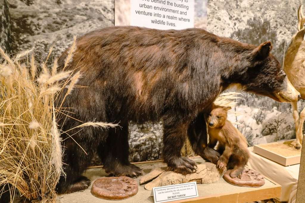
Description: Before or after your hike, consider stopping by the Eaton Canyon Nature Center. It features a variety of exhibits, live animals, and information on local flora and fauna. It’s a great educational spot for families and those interested in learning more about Pasadena’s natural history.
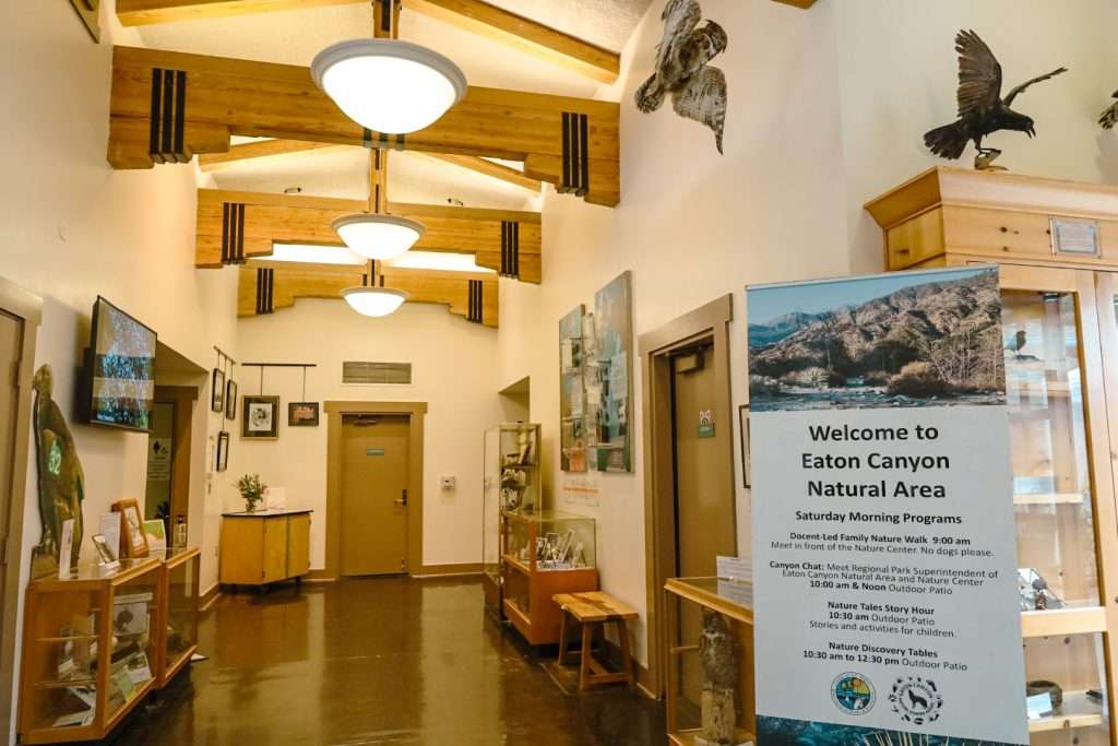
Hours: Vary by season, so it’s best to check ahead.
Inspiration Point via Castle Canyon
Location: The Inspiration Point trailhead begins near the Echo Mountain trailhead, located just above the residential area of Altadena.
Activity: The Inspiration Point trail leads to a vista point known as Inspiration Point, which provides breathtaking views of the San Gabriel Valley and beyond. It’s known for its scenic beauty and challenging climb.
Distance: Approximately 10 miles round trip.
Elevation Gain: Roughly 2,800 feet.
Difficulty: Moderate to challenging. The Inspiration Point trail is steep in sections, and the elevation gain can be demanding for some hikers.
Description: The hike starts at the lower Sam Merrill Trail, leading you to the ruins of Echo Mountain. This segment is approximately 2.5 miles.
From Echo Mountain, follow the signs pointing towards Inspiration Point through Castle Canyon. This part of the trail is shaded, narrower, and steeper as it winds through the canyon.
As you approach Inspiration Point, you’ll find several viewing telescopes and shaded pavilions where you can rest and enjoy the panoramic views. The “viewfinders” at Inspiration Point provide labeled landmarks to help you identify various points of interest in the landscape below.
Inspiration Point Trail Highlights
Ruins of Echo Mountain: Before heading up Castle Canyon, you’ll encounter the remnants of a bygone resort era, including old building foundations and interpretive signs.
Castle Canyon’s Natural Beauty: As you ascend, you’ll traverse a trail shaded by oaks and chaparral, with occasional small stream crossings and beautiful rock formations.
Panoramic Views: Inspiration Point offers stunning views that make the climb worthwhile. On clear days, you can see the Pacific Ocean, which is 40 miles away.
Facilities & Amenities:
– Limited parking near the trailhead. It’s advisable to arrive early, especially on weekends.
– Benches and shaded pavilions at Inspiration Point for resting.
– Informative signs and viewfinders at Inspiration Point.
Safety Tips:
– Always bring plenty of water, as no water sources are along the trail.
– Wear appropriate footwear with good traction, especially since some sections are steep and rocky.
– Check the weather forecast before heading out. The Inspiration Point Trail can be slippery after rain, and the heat is intense in summer.
– Always inform someone of your hiking plans and estimated return time.
Echo Mountain via Sam Merrill Trail
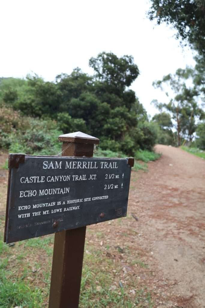
Location: The Sam Merrill Trail starts at the top of Lake Avenue in Altadena at the Cobb Estate gate.
Activity: This hike leads you up to Echo Mountain, where the ruins of the historic White City resort, once a luxurious mountaintop hotel and railway, highlight Pasadena’s history.
Distance: Approximately 5 miles round trip.
Elevation Gain: About 1,400 feet.
Difficulty: Moderate. The Sam Merrill trail is well-maintained with a steady incline, but it can be challenging for those unaccustomed to hiking. As you get closer to Echo Mountain, the trail becomes smaller, more sandy, and curvy.
Description:
The Sam Merrill Trail begins at the Cobb Estate gate, winding its way up the mountainside with switchbacks.
As you ascend, you’ll see views of the Los Angeles basin and, on clear days, the Pacific Ocean. Use binoculars to view Catalina Island. Quick historical note: Catalina Island was previously owned by the Wrigley family, who donated the Pasadena Wrigley mansion to Pasadena’s Tournament of Roses.
Once you reach the summit, you’ll find interpretive signs detailing the history of the White City resort, the Mount Lowe Railway, and the various attractions that once stood there.
Among the White City Resort ruins, you’ll find old building foundations, remnants of the railway, and the famous “Echo Phone” – where visitors in the past would shout to hear their voices echo back.
Highlights:
Historic Ruins: The remnants of the White City resort offer a unique glimpse into Pasadena’s history. Explore the ruins and imagine what the area looked like in its heyday.
Panoramic Views: From the summit, enjoy breathtaking views of the San Gabriel Valley, Downtown Los Angeles, and the distant coastline.
Switchbacks: The series of switchbacks on the Sam Merrill Trail offers a rhythmic hiking experience, with each turn providing a slightly different view of the landscape below.
Facilities & Amenities:
Street parking is available at the trailhead, but it can fill up quickly, especially on weekends. Arrive early to secure a spot.
No restrooms or water sources are on the trail, so come prepared.
Safety Tips:
The Sam Merrill Trail is exposed with limited shade. It’s essential to bring sunscreen, hats, and plenty of water, especially during spring and summer months.
Wear sturdy hiking shoes with good traction, as some sections have loose gravel.
As with any hike, inform someone of your plans and estimated return time.
Arroyo Seco
Location: Arroyo Seco stretches from the San Gabriel Mountains in the north through Pasadena and South Pasadena, eventually meeting the Los Angeles River near Downtown L.A.
Description: Despite its name, Arroyo Seco often has water flowing in parts, especially after rains. The Arroyo Seco trail offers a serene environment to escape Pasadena.
Distance: The Arroyo Seco trail system varies in length depending on where you start and end. It can range from short 1-2 mile walks to longer 10+ mile treks.
Difficulty: Generally easy to moderate but can vary depending on the chosen section.
Trail Overview:
Lower Arroyo Seco: This section of the Arroyo Seco is more developed with easy trails, perfect for families and casual walkers. It includes several parks and recreational areas, like Pasadena’s Lower Arroyo Seco Park.
Central Arroyo Seco: Features the historic Colorado Street Bridge, Rose Bowl, and Brookside Golf Courses. There are wider paths here, often frequented by joggers and cyclists.
Upper Arroyo Seco: This is the more rugged and natural section of the Arroyo, closer to the San Gabriel Mountains. Here, the trail is more secluded, offering opportunities for longer hikes and a closer connection to nature.
Features:
Stream: While not constantly flowing year-round, after rains, the creek becomes a central feature, adding a calming ambiance with the sound of running water.
Bird Watching: The Upper Arroyo Seco is rich in birdlife. Enthusiasts might spot species like the Black Phoebe, Red-tailed Hawk, or the Northern Flicker.
Nature Areas: The Arroyo Seco boasts various habitats, from woodlands to grasslands, attracting various wildlife.
Recreation: The broader Arroyo Seco area has archery ranges, disc golf courses, and other recreational amenities.
Facilities & Amenities:
There are multiple locations in the Arroyo Seco with available parking spaces.
Restrooms are accessible in the more developed park sections.
Some picnic areas and benches are scattered throughout, particularly in the lower and central regions.
Safety Tips:
After heavy rains, the stream can swell. Always be cautious near water, and never attempt to cross fast-moving currents.
If birdwatching, consider bringing a pair of binoculars and a guidebook.
Stay on designated paths to protect the environment and for personal safety.
Arroyo Seco offers a refreshing escape in the heart of urban surroundings. Whether you are seeking a quiet walk by the creek, birdwatching, or a more vigorous hike, the area provides a unique blend of natural and urban experiences. Enjoy your time in this historic and beautiful canyon!
Pasadena’s Gabrielino Trail

Distance: This Gabrielino Trail stretches about 28 miles in total, but the section that goes through Arroyo Seco is roughly 11 miles.
Description: One of the most renowned trails in the region, the Gabrielino Trail winds through the heart of the Arroyo Seco, following the creek and passing through woodlands and riparian habitats.
Difficulty: Moderate, with some sections that can be more challenging.
Lower Arroyo Seco Trail
Distance: About 3 miles round trip.
Description: A more developed and flatter path, perfect for casual strolls. This Pasadena trail offers views of the historic Colorado Street Bridge and moves around the edges of the local archery range.
The Lower Arroyo Seco trail is less crowded during weekdays, so be cautious and prioritize safety. On weekends, the trail is more busy. Also, be wary of local wildlife. You are likely to see squirrels and coyotes.
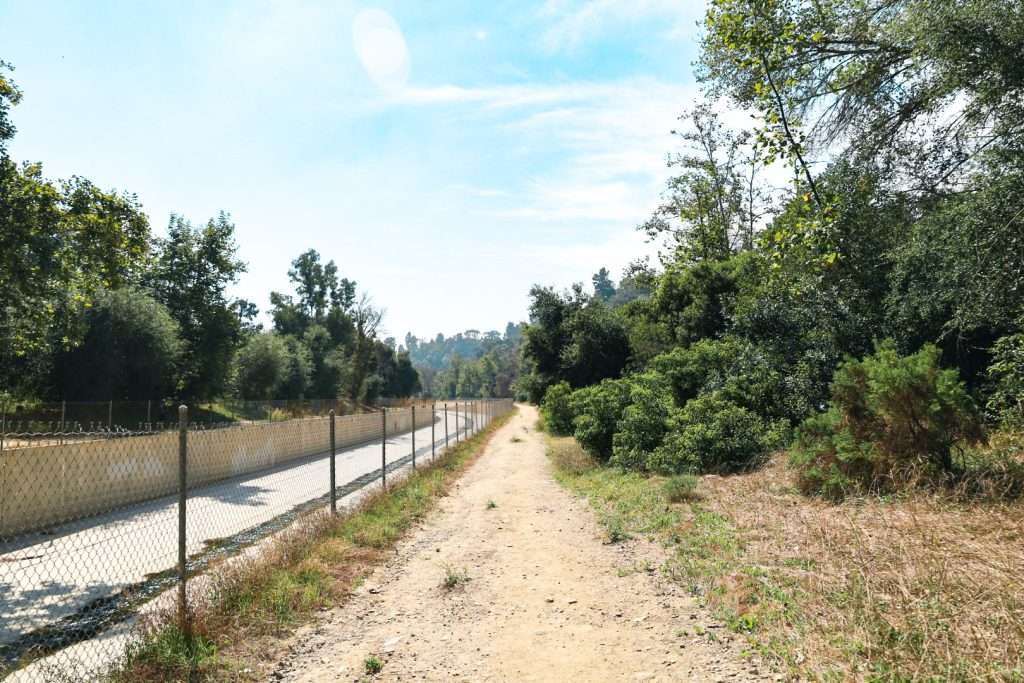
Difficulty: Easy.
El Prieto Trail
Distance: Approximately 5 miles round trip.
Description: Located in the Upper Arroyo Seco area, this trail is a bit more secluded and takes hikers through oak woodlands with the creek often in sight. It’s known for its wildflowers during spring.
Difficulty: Moderate, with some steep sections.
Gould Mesa Trail
Distance: Around 2.5 miles round trip.
Description: The Gould Mesa trail is a peaceful trail that follows along a creek, leading to the Gould Mesa Campground. It’s great for those looking for a short, scenic hike or even an overnight camping experience.
Difficulty: Easy to moderate.
Hiking in Pasadena’s Arroyo Seco
For any of these Pasadena trails, it’s essential to:
– Wear appropriate footwear.
– Bring plenty of water, especially during warmer months.
– Check weather conditions before heading out.
– Stay on designated paths to protect the environment and for personal safety.
Outdoor things to do in Pasadena
In Pasadena, hiking is one of the best outdoor things to do. The Eaton Canyon Trail, Gabrielino Trail, and Lower Arroyo Seco Trails offer hikers a chance to experience diverse landscapes, encounter local wildlife, and enjoy breathtaking views of the San Gabriel Valley and beyond.

