

Nestled in the foothills of the San Gabriel Mountains, Altadena, California borders the Northwest edge of Pasadena. Altadena offers some of the most scenic and enjoyable hiking trails in the Los Angeles area.
Whether you’re a seasoned hiker looking for a new challenge, or a beginner seeking a leisurely stroll amidst stunning landscapes, Altadena has something for everyone. Altadena has a variety of trails featuring waterfalls (during winter months), panoramic city views, and even a historic railway route, with difficulty levels ranging from easy to strenuous.
Key Takeaways
- Altadena offers a variety of scenic hiking trails for all experience levels
- Hikers can encounter waterfalls, panoramic views, and historical landmarks
- Proper planning and knowledge of the trails ensures a safe and enjoyable hike
Hiking in Altadena
Altadena is one of the best areas in Southern California for hikers, offering numerous trails that cater to various skill levels and interests.
Eaton Canyon Trails: One of the most popular hiking destinations in Altadena is Eaton Canyon Natural Area Park. This expansive park features a 3.5-mile trail that takes hikers from the nature center to a stunning waterfall. Along the route, hikers can expect to encounter various species of birds, mammals, and reptiles, as well as an array of native plants.
Sam Merrill Trail: Another hiking trail is the Sam Merrill Trail, which leads to the historic site of Echo Mountain and the abandoned ruins of the Mount Lowe Railway and the Cobb Estate. This 5-mile round trip hike offers panoramic views of the surrounding mountains and Pasadena below.
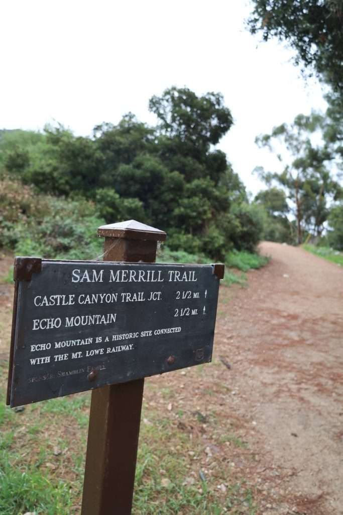
Inspiration Point: For hikers interested a more challenging hike, the trail to Inspiration Point is one of the best choices. This 7.5-mile round trip hike takes hikers through a series of switchbacks and steeper sections, rewarding them with breathtaking views from the famed vista.
Angeles National Forest: Altadena’s nearby Angeles National Forest and San Gabriel Mountains National Monument offer countless more options for serious hikers.
Popular Hiking Trails
Echo Canyon Trail
Echo Canyon Trail is one of the best hiking trails in Altadena. Echo Canyon Trail starts at the base of the Eaton canyon and ascends through various switchbacks, leading hikers through a beautiful landscape of diverse flora and fauna. Along the hike, one can observe a mix of chaparral, oak woodlands, and pine forests. You can reach the trail on Altadena Drive.
Hiking to Cobb Estate
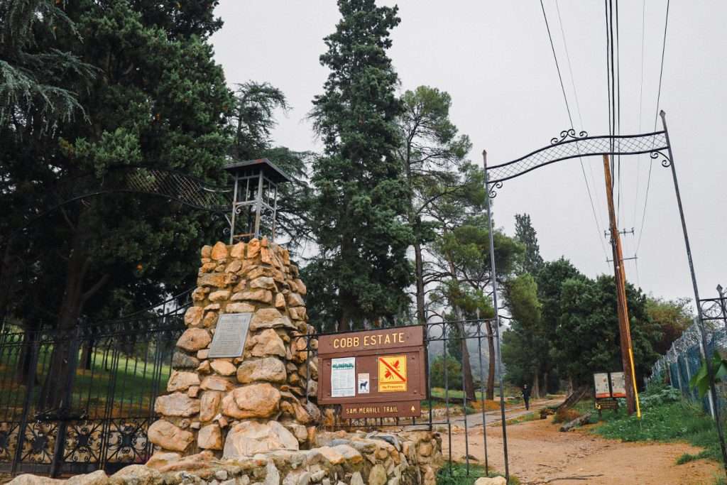
Cobb Estate is a popular hiking spot in Altadena that can be reached via the Sam Merrill Trail. It’s an interesting place to visit because it has a ruined mansion that used to be grand and beautiful. Visitors can see what’s left of the mansion and enjoy the view. On a clear day, you can see the Pacific ocean.
Sam Merrill Trail
The Sam Merrill Trail is a popular hiking trail that starts at the edge of Altadena. Originally a railroad track, the trail offers an excellent workout with a steady ascent and remarkable views of the surrounding area. Hikers can choose from various loops, depending on their fitness levels and time constraints, making it suitable for all skill levels.
Sunset Ridge Trail
Sunset Ridge Trail is a favorite among many hikers for its stunning panoramic views of the Los Angeles basin. The trail, which starts at Millard Canyon, leads to the top of popular peaks like San Gabriel Peak and Mount Lowe. Along with the breathtaking city views, hikers can also enjoy the sight of abundant wildflowers in the spring season.
Difficulty Levels
Easy Hikes
Altadena offers a variety of easy hikes for those who are new to hiking or simply want a leisurely experience. These hikes typically feature gentle slopes and well-maintained trails, allowing hikers to enjoy the scenery without too much physical effort. One great example of an easy hike in Altadena is the Arroyo Seco Trail. This relatively flat trail is ideal for beginners as it meanders along a shaded creek with a wide path, making it a refreshing and enjoyable hike.
Another easy hike is the Altadena Crest Trail, which offers stunning views of the city and surrounding mountains. Despite minimal incline, hikers can still appreciate the beauty of the area without breaking a sweat.
| Trail Name | Distance | Elevation Gain |
|---|---|---|
| Arroyo Seco Trail | 3.5 miles | 300 feet |
| Altadena Crest Trail | 4 miles | 350 feet |
Challenging Hikes
For more experienced hikers seeking a challenge, Altadena delivers some steep trails that require a higher level of fitness and skill. These challenging hikes often include steep inclines, switchbacks, and uneven terrain.
One of the best challenging hikes in Altadena is the Sam Merrill Trail. This steep trail ascends over 1,400 feet and covers nearly 5 miles round trip. The hike becomes progressively steeper as it climbs, providing a rewarding workout for those up for the challenge.
Altadena’s Sunset Ridge Trail is another challenging hiking trail. This hiking trail gains nearly 2,000 feet in elevation over the course of 6 miles, with steep switchbacks and rocky terrain. Hikers should be prepared for a substantial workout when tackling these challenging hikes.
| Trail Name | Distance | Elevation Gain |
|---|---|---|
| Sam Merrill Trail | 5 miles | 1,400 feet |
| Sunset Ridge Trail | 6 miles | 2,000 feet |
Hikers of all skill levels can find suitable trails in Altadena, whether they prefer easy strolls or more challenging adventures. By selecting the appropriate trail, individuals can ensure they have a memorable experience tailored to their abilities.
Planning Your Hike
Timing Your Hike
Similar to Pasadena’s climate, Altadena has a moderate climate but can get extremely hot during the summer months. Taking into account the sunrise and sunset times is crucial for a safe and enjoyable experience. The best time to visit Sunset Ridge is during the early morning or late afternoon, as these periods offer comfortable temperatures.
Remember to check the local weather forecast before heading out and be prepared for any sudden changes in temperature or rain.
Park Gate Hours
The park gate in Altadena operates on specific hours, which hikers must be aware of when planning their hike. Gates typically open around sunrise and close around sunset, but the exact schedule may vary based on the season, especially after a heavy rain. Closed gates can result in limited trail access, making proper time management vital for a successful hike.
| Opening Hours | Closing Hours | |
|---|---|---|
| Sunrise Gate | Sunrise | Sunset |
| Sunset Ridge Gate | 6:00 AM | 10:00 PM |
Please note that the information above is subject to change, so verify the gate hours directly with the park you intend to visit. This way, you can ensure a smooth and hassle-free hiking trip that fully takes advantage of Altadena’s scenic trails.
Hiking in La Canada
Hike the Gould Mesa Trailhead
The Gould Mesa Trailhead is a popular hiking destination located at an elevation of 1,500-feet. The trailhead offers visitors a range of amenities, including 5 hike-in campsites equipped with picnic tables and campfire rings, vault toilets, and trash receptacles. However, there is no piped water available at the site, and visitors are advised to treat or boil water from the seasonal stream before using it. Hikers and campers are encouraged to bring enough water for cooking, cleaning, drinking, and extinguishing campfires.
The Gould Mesa Trailhead is also equipped with equestrian amenities, including three hitching rails (52 linear feet) for horses and stream water available for horses. The trailhead provides access to the Gabrielino National Recreation Trail, which is adjacent to the trail camp. Visitors can enjoy hiking on the trail and taking in the scenic views of the surrounding landscape.
The Gould Mesa Trailhead is an excellent destination for hikers and equestrians looking to explore the natural beauty of the San Gabriel Valley. Visitors are advised to come prepared with enough water and supplies for their trip and to follow all posted rules and regulations to help preserve the natural environment.
Directions to Gould Mesa Trailhead
From Pasadena, take the 210 west and exit 20 for CA-2/Angeles Crest Hwy toward La Cañada Flintridge. Make a right onto CA-2 E/Angeles Crest Hwy. Drive for 2 miles and the entry to Gould Mesa Trail will be in the right.
Frequently Asked Questions
Which hikes offer the best views near Altadena?
Several hikes near Altadena provide stunning views. The Echo Mountain Trail offers a panoramic view of Los Angeles, while the Sam Merrill Trail leads hikers to the ruins of the Mount Lowe Railway. For those who prefer a more secluded experience, the Millard Canyon Falls Trail provides a serene view of a waterfall.
Which hikes are dog friendly?
Many hikes near Altadena are dog-friendly, with some popular choices being the Eaton Canyon Trail, and the Lower Sam Merrill Trail. It’s important to keep your dog on a leash and abide by any posted trail regulations for the safety and enjoyment of all hikers and their pets.
How challenging is the Echo Mountain hike?
The Echo Mountain hike is moderately challenging, with an elevation gain of about 1,400 feet and a round-trip distance of approximately 5 miles. Hikers should expect to encounter steep inclines, uneven terrain, and switchbacks. Proper footwear and adequate water supply are recommended.
What can be expected on the Rubio Canyon Trail?
The Rubio Canyon Trail is a 1.3-mile out-and-back trail featuring lush vegetation and several cascading waterfalls. It is rated moderately difficult due to some steep and rocky sections. Hikers can expect to navigate through narrow, rocky paths and cross the stream several times. The trail is best enjoyed during the winter and spring seasons when the waterfalls are more active.
How do I get to Inspiration Point in Altadena?
To reach Inspiration Point, one can take either the Castle Canyon Trail or the Sam Merrill Trail. The Castle Canyon Trail is shorter but steeper, while the Sam Merrill Trail is a more gradual ascent. Both trails connect at Echo Mountain and continue as the Middle Sam Merrill Trail to Inspiration Point. Round-trip distances are approximately 10 miles for the Castle Canyon route and 11 miles for the Sam Merrill route.

